

On the Oregon Trail of Smoke
By Dr. Toby Ault, Associate Professor in Department of Earth and Atmospheric Sciences at Cornell University and PRI Research Associate
Published November 17, 2026.
About This Series: In the summer of 2026, I strapped a couple of air-quality sensors to a rental car and drove it across the country to where some of the largest fires in the West were burning. With my daughter’s help, we built passive and active low-cost wet and dry aerosol collectors along the way. The goal was to learn as much as we could about which low-cost systems would be most effective and easily reproducible, so that ultimately we can scale this endeavor up across the West and learn more about what wildland firefighters (and really all of us, eventually) are breathing during these events.
The focus is on wildland firefighter health and exposure, because it is these courageous men and women who face not only the acute hazards of unprecedented megafires, but the potential long-term health consequences of breathing this smoke season after season.
The climate outreach team at PRI (Ingrid, Rob, Don, and Alex) and my lab, ECRL (Swatah, Alice, Carlos, and Elsa), decided that rather than wait the usual two years for data and sample processing, analysis, peer review, and publication to unfold, we would show you (science teachers and future scientists) how the sausage is made while we are making it. This series, like science itself, is a work in progress.
Introduction
In August, I followed the trail of smoke in the atmosphere from Ithaca to Ohio to St. Louis, then up through Nebraska, Wyoming, Idaho, and ultimately into eastern Oregon and Washington, where it was originating.
Cornell Alumni funded the project, whose primary goal was to collect as much data as possible about the air quality and composition of smoke aerosols in places where wildland firefighters work and sleep.
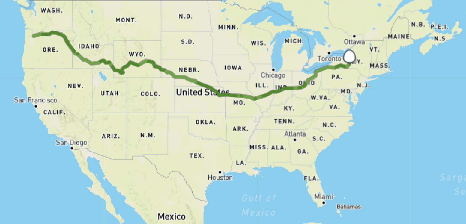
GPS Coordinates from Air Quality Egg (sensors) mounted on the roof of our rental car.
I had two sensors running on the outside of the car and a third measuring air quality inside the car (which was filtered using the standard Jeep Compass cabin air filter), as well as a number of prototypes and protocols I was testing to determine how viable they might be for low-cost aerosol collection. My primary objective was to sample as much of the Pacific Northwest as I could, to develop a picture of the vertical and horizontal distribution of smoke, its possible composition, and, most especially, the air quality in places where wildland firefighters sleep and work.
The route followed the path settlers took on the Oregon Trail pretty closely. The reason is that settlers, like the smoke, followed lower-elevation routes and valleys. I had initially thought this detail was just a funny coincidence based on how the winds were blowing. However, the reasons for it (and their implications) would turn out to be pretty significant later on.
Originally, my plan with collaborators at NAU had been to send the equipment out with firefighters themselves. We had not fully tested the protocols, however, and we did not feel that all of our sampling strategies were operationally ready for prime time. So I decided to test them myself and see what refinements we need to make before next summer to turn this into a viable initiative.
Oh, and one last note: I was joined by my 17-year-old daughter, who, at the very last minute (just days before my departure) persuaded me to take her along. I agreed under the conditions that she would help navigate, interpret forecasts, monitor equipment, help design samplers, and DJ. Her notes, observations, and commentary will appear in inset boxes throughout this article.
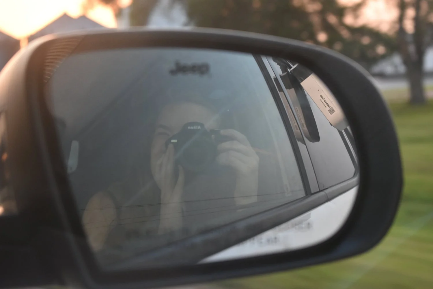
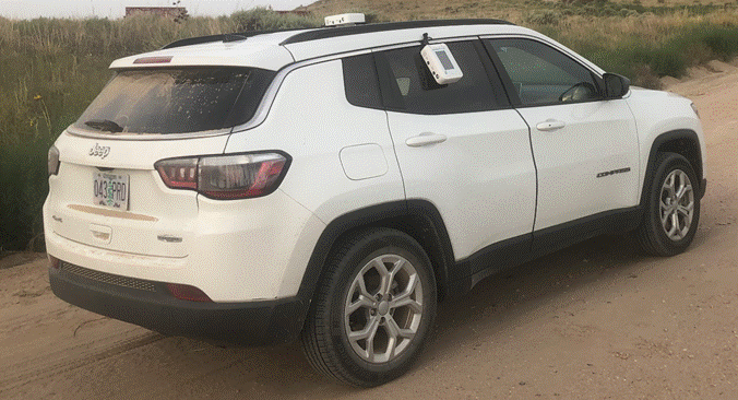
Photographer, navigator, field assistant, and DJ (left) and sensor (right). For the duration of the 2.5 weeks, this vehicle served as a mobile lab.
Elsa's Notes: It is a bit misleading to say that I decided to join “at the last minute” because, in reality, the entire road trip was conceived only a few days before it began. So, there was no other time when I could have decided to go other than “the last minute.”
Work in Progress
A very strong caveat must preface everything that follows: this research is a work in progress. Earlier in my career, I would not have dreamt of posting this much information about my motivation, methods, or preliminary findings without at least one paper accepted for publication after extensive peer review. Yet here I want to give you a snapshot, a small look behind the curtains, at how science actually looks in as close to real time as possible. What I am sharing here hasn’t been polished, or sanitized, or even edited thoroughly! It is a look at what we set out to do, what we learned, and what is next.
Accordingly, please keep in mind that the preliminary findings are just that: preliminary. They haven’t been subject to peer review, or even to an extensive review of the literature. This should not be read as a final scientific report.
Even so, I think there are some initial findings that are relevant for anyone concerned about exposure to wildfire smoke, especially if you like to spend time outdoors in the summer camping, rafting, hiking, or kayaking. Plus, we tested some additional equipment that might improve air quality inside the tents where firefighters sleep.
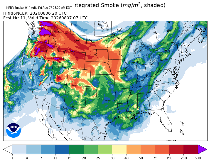
August 6th HRRR (High-Resolution Rapid Refresh) Smoke Forecast.
How did we get into this mess?
Below, you can find links to articles written by authors who know much more about the current state of fire ecology than I do.
Recommended Reading:
Stephen J. Pyne, The Pyrocene: How We Created an Age of Fire, and What Happens Next— A broad historical and ecological account of how human societies have reshaped fire regimes and entered what Pyne calls an age of fire.
John Vaillant, Fire Weather: A True Story from a Hotter World — A highly readable account of modern wildfire, climate, infrastructure, and human vulnerability, centered on the Fort McMurray fire.
National Geographic, “Wildfires in the West Are Inevitable, but This Strategy Can Help Control Them” — A concise overview of wildfire ecology, prescribed fire, fuel buildup, and the challenges of managing western forests.
To keep things simple, here I am merely summarizing what I learned from my host in eastern Washington, Joseph Jones, a former Oregon Museum of Science and Industry (OMSI) camp director and volunteer wildland firefighter with six decades of experience.
A Fiery History
For thousands of years, ecosystems across North America evolved with fire. Indigenous people used fire deliberately for land management, and historically natural and anthropogenic fire cycles occurred much more frequently than they do under modern fire-suppression regimes. Intentional burning often involved frequent, low-severity fires that helped maintain open landscapes and affected the accumulation and distribution of fuels (e.g., Steen-Adams et al., 2019; see also National Geographic for a broader and very readable overview of the long history of Indigenous cultural burning across western North America).
Indigenous groups suffered catastrophic population declines from introduced diseases, forced relocation and other active government efforts that dispossessed and disenfranchised entire communities. In the Pacific Northwest, for example, populations plummeted by a factor of approximately one hundred between the late 18th (just before the Lewis & Clark Expedition) and late 19th centuries.Think about that for a moment: for every one person alive in the late 19th century, there would have been 100 people just a few generations earlier (Kelly et al., 2025); National Parks Service article on Lewis & Clark’s Expedition’s impact on indigenous people).
European colonization not only displaced Indigenous communities but also actively suppressed their traditional fire-management practices. In California, intentional burning was criminalized as early as 1850, and subsequent state and federal fire-exclusion policies further restricted Indigenous cultural burning (Lake et al., 2024).
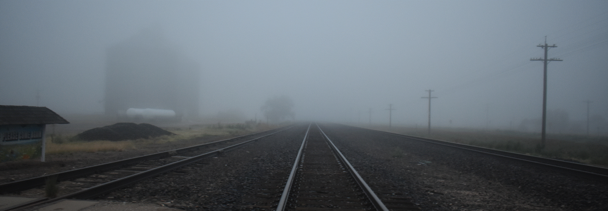
Smoke and fog near Ogallala, NE. This portion of the Oregon Trail follows the Upper Platte River, and the railway lines follow the same course.
From the late nineteenth century onward, expanding railroads, industrial technologies, and global demand for timber transformed forests across the Pacific Northwest. Logging removed much of the region’s old growth, including many of the large trees that had shaped these ecosystems for centuries (Strittholt et al., 2006; Hessburg et al., 2019). By 1905, a century after Lewis and Clark reached the Pacific Ocean, many of the ecosystems would have become unrecognizable, and as it turns out, unstable.
Massive fires in 1910 pushed the nascent U.S. Forest Service towards a more ambitious role in suppressing fires. In the decades that followed, especially after WWI, we gained resources, technologies, and capacities for mobilizing large numbers of people and machines to fight fires. In one of our conversations, Joseph Jones recounted how his father in law (who worked for the US Forest Service) had to abide by the “10 a.m. policy:” any wildfires were supposed to be under control by 10 a.m. on the day after they were detected or there would be “hell to pay” (e.g., US Forest Service).
In a way, we became victims of our own success: decades of suppression reduced the number of fires and allowed fuels and vegetation to accumulate (e.g., National Geographic interview with Stephen Pyne).
By the postwar era of the 1950s, fire-suppression technologies had matured, while people continued moving west and building suburbs, roads, utilities, and other infrastructure ever closer to fire-prone forests. In fact, the “interface” between urban areas and wildland forests grew faster than it did in any other category of land use; between 1990 and 2010, approximately 12 million new homes were built at the wildland-urban interface (Radeloff et al., 2018). Much of this development preceded modern wildfire-resistant building standards, which still vary by region and state and are not always seen favorably by voters (see NPR Article from 17 August, 2026). And, of course, homes are still being built adjacent to forests that might soon burn.
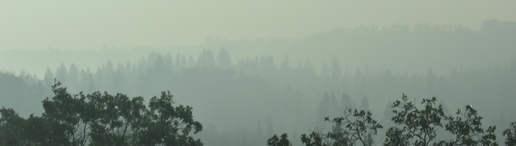
The details of this overarching narrative differ from one ecosystem to another. Even the forests east and west of the Cascades do not have the same fire cycles or composition. Fire regimes and hazards also vary with elevation, microclimates, soil types, vegetation, and a host of other variables that we do not have time to get into here.
There are also enormous natural variations in weather patterns from one year to the next, or in some cases from one decade to the next. Some of these variations can be driven by El Niño and La Niña events, which will deliver excess moisture and favor growth during one year, then suppressed precipitation and increased drought in subsequent years.
Finally, lurking in the background, just barely out of frame but always present, we have the meddling, monstrous threat that we call climate change. So far, it has already increased temperatures and atmospheric aridity and contributed to the drying of western forest fuels. Even a decade ago, two of the absolute best researchers in climate science today (Drs. John Abatzoglou and Park Williams) estimated that anthropogenic climate change accounted for roughly 55 percent of the observed increase in western U.S. forest fuel aridity from 1979 to 2015 and nearly doubled the cumulative forest-fire area attributable to that increase in fuel aridity (https://doi.org/10.1073/pnas.1607171113).
Who pays the price of mismanagement, growth, and climate change?
In a way, we all do through our exposure to smoke, losses of natural areas, and higher insurance premiums. But nobody is more directly exposed to the immediate physical hazards and long-term health consequences of wildfires than the firefighters who keep the rest of us safe. What do we owe them?
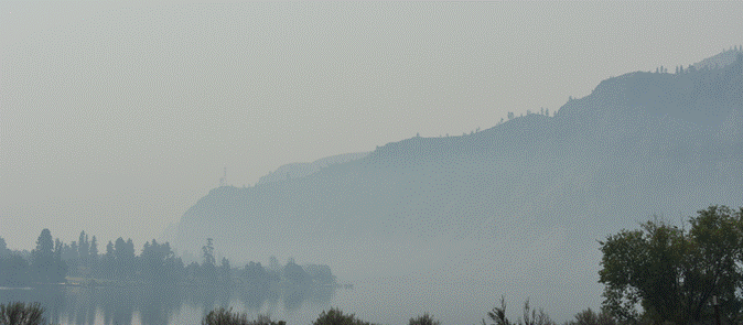
Smoke near the surface of the upper Columbia River near Entiat, WA. Less than a mile away from here we passed the firecamp with several hundred tents belonging to the wildland firefighters.
Note: It has become fashionable to put Results before Materials and Methods in some high end journals. To that end, you may find all the fun stuff in the Appendices, while the most immediate and impactful findings (those which are also least likely to change) can be found below.
Results & Discussion
Smoke concentrations depend intimately on elevation, particularly in settings where strong nighttime inversions trap smoke in valleys.
We visited two fire camps. One in Oregon, a little north of Maupin in the White River Valley, and the other in Washington, along the Columbia River near the mouth of the Entiat River Valley. In both cases, air quality was substantially worse at night and in the early morning, precisely where firefighters were camping. In some cases, concentrations of PM1, PM2.5, and PM10 were higher in these valleys than at locations closer to the front lines of the fires themselves.
This can be seen very clearly in Figure 1, which reports the Air Quality Index (AQI), along with PM10, PM2.5, and PM1 concentrations, from a location within a few hundred meters of the White River fire camp in eastern Oregon, between approximately 7:00 and 8:15 in the morning. Particulate concentrations were well above healthy exposure levels.
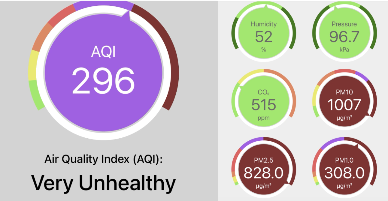
Figure 1. Air Quality Index (AQI), calculated from one of the two sensors mounted on the exterior of the vehicle, at a site within a few hundred meters of the White River Valley wildland firefighter camp in eastern Oregon. AQI was calculated using the EPA NowCast method, which gives greater weight to the most recent hours. The right panel shows five-minute averages of humidity, pressure, CO2, PM10, PM2.5, and PM1. Particulate concentrations were well above healthy exposure levels.
The same dependence is readily apparent in Figure 2, which shows the spatial distribution of smoke concentrations along Highway 197, between The Dalles and Maupin, Oregon. The locations of the firefighter camp and the surrounding valleys are particularly notable.
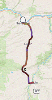
Figure 2. Spatial distribution of PM2.5 concentrations along the transect from The Dalles through Dufur to Maupin, Oregon, and back. The location of the firefighter camp is marked with an X. Darker colors indicate higher particulate concentrations.
Finally, Figure 3 shows PM2.5 concentrations alongside the elevation of the sensors along the same transect. The relationship between topography and smoke concentrations is striking, with the lowest elevations generally experiencing the highest concentrations.
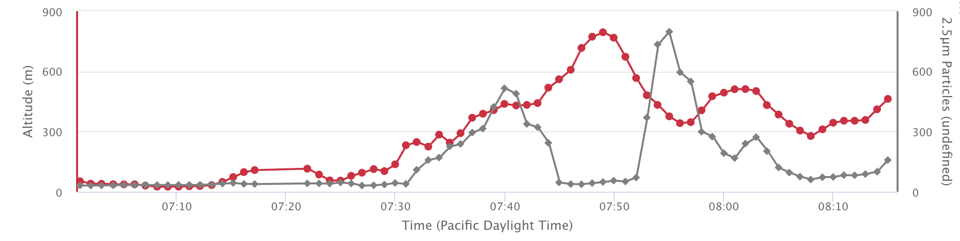
Figure 3. PM2.5 concentrations (right axis) and elevation (left axis) along the transect between The Dalles and Maupin, Oregon, illustrating the relationship between topography and smoke concentrations.
Encouragingly, we also found that a potentially inexpensive solution, which we call the Griderfan, might substantially reduce exposure to smoke inside the tents where firefighters sleep.
The Griderfan consists of a small USB-powered fan, a spacer or tube, and a face-mask filter, assembled using ordinary materials available from hardware stores such as Home Depot or Lowe's for less than about $15. Figure 4 shows the design, along with examples constructed and tested inside a two-person REI tent, representative of the kinds of tents used by wildland firefighters.
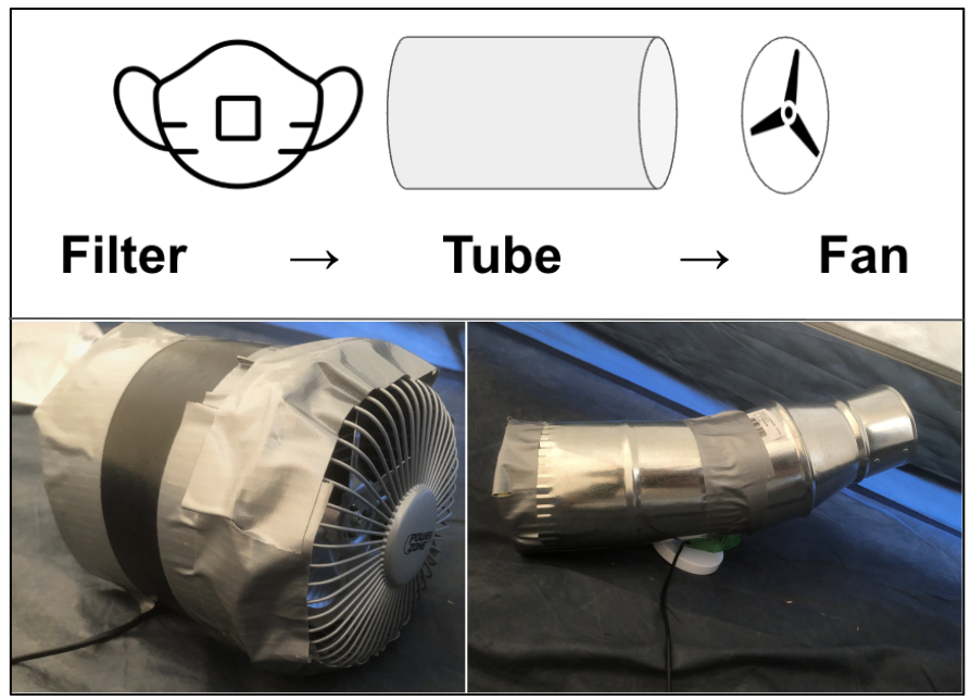
Figure 4. Griderfan design (top) and examples constructed and tested inside a two-person REI tent (bottom). The system uses inexpensive, readily available materials and costs approximately $15 or less.
Figure 5 shows PM2.5 concentrations inside a tent during one of these tests. Consistent with other preliminary trials, concentrations began above 250 µg/m³ and declined to approximately 100 µg/m³ within about 45 minutes while the Griderfan was operating.
These are only initial results. Future work will need to establish what is actually present in the smoke, using combinations of chemical and physical sampling, biological analyses including PCR, and elemental analyses using ICP techniques.
For now, however, we have learned two important things. First, the well-known dependence of smoke concentrations on elevation means that nighttime inversions may substantially influence firefighters' exposure to smoke, particularly in certain topographic settings. Second, relatively simple, low-cost interventions may offer a practical means of reducing exposure, potentially substantially, if they can be demonstrated to work reliably and implemented at scale.
Both findings have implications for protecting the health of the people who spend their summers fighting these fires.
Future Work
Our primary objective was to develop sampling equipment and protocols that could eventually be deployed by firefighters themselves. This expedition was an initial test of that concept. We learned a great deal about what worked, what failed, and what needs to be improved. With additional development and collaboration, we hope to assemble a set of inexpensive, reliable instruments that can be deployed in the field to characterize smoke exposure and evaluate practical measures to reduce it.
There is still a great deal to do. First, we need to analyze the aerosol samples we collected to better understand what is actually in the smoke, using microscopy, elemental analysis (ICP), and molecular techniques such as PCR. Second, we want to investigate the relationship between smoke concentrations, topography, and meteorological conditions, particularly the nighttime inversions that appear to produce such poor air quality where firefighters sleep. Finally, we plan to continue developing and testing the Griderfan, along with our inexpensive sampling instruments, to determine whether these technologies could be deployed more widely in the field. Ultimately, our goal is to better understand the risks faced by wildland firefighters and develop practical, inexpensive ways to reduce their exposure.
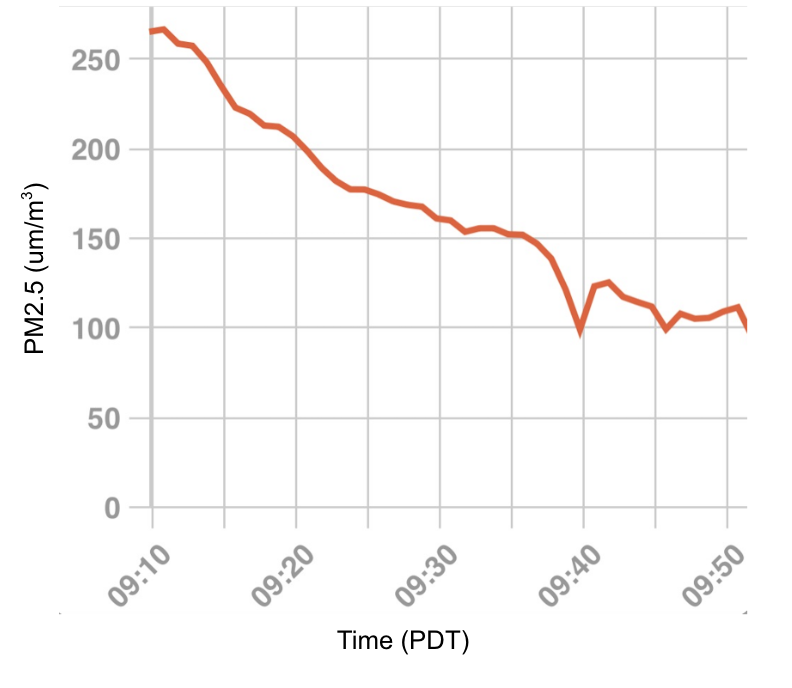
Figure 5. PM2.5 concentrations inside a tent during a preliminary Griderfan test. Concentrations declined from above 250 µg/m³ to approximately 100 µg/m³ over approximately 45 minutes while the fan was operating.
Acknowledgments
I am extremely grateful to the Cornell alumni donors whose generous support made this work possible, as well as the Atkinson Center for Sustainability and the Einhorn Center for Community Engagement.
Special thanks to Joseph and Connie Jones for their extraordinary hospitality and generosity; Neil Chapman for his helpful comments and historical framing; and Paulo Otrogge, Mark Galliard, and Nick McKay for their contributions and support.
Throughout the journey, I was frequently reminded of a passage near the end of Charles Darwin's The Voyage of the Beagle, in which he reflects on the many kind-hearted strangers encountered during his travels, people he would probably never meet again, but "who yet are ready to offer him the most disinterested assistance."
Finally, I want to thank the dozens of wildland firefighters and smokejumpers who were willing to share even a few minutes of their stories with me in hotel lobbies, restaurants, gas stations, and fast-food lines along the way.
Thank you all for everything you risk and everything you do to keep the rest of us safe.
Bibliography
Abatzoglou, J. T., & Williams, A. P. (2016). Impact of anthropogenic climate change on wildfire across western US forests. Proceedings of the National Academy of Sciences, 113(42), 11770–11775. https://doi.org/10.1073/pnas.1607171113
Borunda, A. (2021, September 3). Wildfires in the West are inevitable, but this strategy can help control them. National Geographic. https://www.nationalgeographic.com/environment/article/wildfires-in-the-west-are-inevitable-but-this-strategy-can-help-control-them
Forest History Society. (n.d.). The 1910 fires. https://foresthistory.org/research-explore/us-forest-service-history/policy-and-law/fire-u-s-forest-service/famous-fires/the-1910-fires/
Hessburg, P. F., Miller, C. L., Parks, S. A., et al. (2019). Climate, environment, and disturbance history govern resilience of Western North American forests. Frontiers in Ecology and Evolution, 7, Article 239. https://doi.org/10.3389/fevo.2019.00239
Kelly, R. L., Mackie, M. E., Pelton, S. R., & Robinson, E. (2025). Spatiotemporal distribution of the North American Indigenous population prior to European contact. Proceedings of the National Academy of Sciences, 122(6), e2419454122. https://doi.org/10.1073/pnas.2419454122
Lindo, J., Huerta-Sánchez, E., Nakagome, S., Rasmussen, M., Petzelt, B., Mitchell, J., Cybulski, J. S., Willerslev, E., DeGiorgio, M., & Malhi, R. S. (2016). A time transect of exomes from a Native American population before and after European contact. Nature Communications, 7, Article 13175. https://doi.org/10.1038/ncomms13175
Lake, F. K., et al. (2024). Evolving wildlife management cultures of governance through Indigenous Knowledges and perspectives. Journal of Wildlife Management. https://doi.org/10.1002/jwmg.22584
Mann, C. C. (2020, December 17). 'There's good fire and bad fire.' An Indigenous practice may be key to preventing wildfires. National Geographic. https://www.nationalgeographic.com/history/article/good-fire-bad-fire-indigenous-practice-may-key-preventing-wildfires
Merschel, A., Vora, R. S., & Spies, T. (2019). Conserving dry old-growth forest in Central Oregon, USA. Journal of Forestry, 117(2), 128–135. https://doi.org/10.1093/jofore/fvy085
National Park Service. (2023, November 29, last updated). The expedition's impact on Indigenous Americans. Lewis and Clark National Historic Trail. https://www.nps.gov/articles/the-expeditions-impact.htm
Nijhuis, M. (2015, November 22). How fire, once a friend of forests, became a destroyer. National Geographic. https://www.nationalgeographic.com/adventure/article/151122-wildfire-forest-service-firefighting-history-pyne-climate-ngbooktalk
Pyne, S. J. (2022). The Pyrocene: How we created an age of fire, and what happens next. University of California Press. https://www.ucpress.edu/books/the-pyrocene/paper
Radeloff, V. C., Helmers, D. P., Kramer, H. A., Mockrin, M. H., Alexandre, P. M., Bar-Massada, A., Butsic, V., Hawbaker, T. J., Martinuzzi, S., Syphard, A. D., & Stewart, S. I. (2018). Rapid growth of the US wildland-urban interface raises wildfire risk. Proceedings of the National Academy of Sciences, 115(13), 3314–3319. https://doi.org/10.1073/pnas.1718850115
Steen-Adams, M. M., Charnley, S., McLain, R. J., Adams, M. D. O., & Wendel, K. L. (2019). Traditional knowledge of fire use by the Confederated Tribes of Warm Springs in the eastside Cascades of Oregon. Forest Ecology and Management, 450, Article 117405. https://doi.org/10.1016/j.foreco.2019.06.002
Strittholt, J. R., DellaSala, D. A., & Jiang, H. (2006). Status of mature and old-growth forests in the Pacific Northwest. Conservation Biology, 20(2), 363–374. https://doi.org/10.1111/j.1523-1739.2006.00384.x
U.S. Department of Agriculture, Forest Service. (2023, July). Fire Management Today, 81(2). https://www.fs.usda.gov/sites/default/files/fire-management-today/FMT-81-2.pdf
Vaillant, J. (2023). Fire weather: A true story from a hotter world. Alfred A. Knopf. https://www.penguinrandomhouse.com/books/554938/fire-weather-by-john-vaillant/
Appendix I: An APUSH (Advanced Placement United States History) Perspective
A FEW MORE NOTES:
The scientific details of this post overshadow an important ongoing part of the trip: Elsa’s knowledge of US history. A few weeks after we got home, I tried to interview her and jot down the essence of these thoughts. When did you realize this wasn’t going to be a normal road trip? Well, I knew that it was going to unhinged from the start. I’d been on a trip with my father before to do field work. Last time we drove something like 400 miles, launched a giant kite in the desert during a dust storm with so much lifting power it threw my dad into the air like a rag doll, visited the Grand Canyon, and ended up in Tucson, AZ to visit my grandmother. All of this transpired in less than 4 days. What caught your attention or surprised you? What do you think you’ll remember years from now? Wyoming in all its vastness. Also, the weird way they portray the history of the trail, especially in older museums or historical sites. It seems like many are still stuck in the narratives from the 200th year anniversary of the US during the 1950s when the west was “won,”Also, there were some things you missed. Specifically, the bathroom where we stopped to get groceries in Scott’s bluff. There were plastic shower curtains, and behind the curtains with all sorts of raw foods, butchering meats, and the bathroom was right adjacent to it. You didn’t register this, and it was really, really, really dirty. It looked like something out of a horror movie. You said, “huh, I didn’t notice. It just looked like the 1980s.”
What could have been done differently? To do this right, obviously, to look at what is in the smoke, you’d need an inductively coupled mass spectrometer, which was outside of your budget. It would have also been better if we’d, you know, planned anything. But given what we were working with, I think it went really well. It will be interesting to see what contaminants we find in the lead.Also, I didn’t think the box with a piece of tape on top would be useful, and it wasn’t.
Were there any people or characters that stood out along the way? There was that guy at Independence Rocks who said he thought you were a spy. And then you acted like a spy. You said something like, “oh, yeah, we’re just driving to Boise,” because you knew he was probably pretty conservative and you didn’t want to get into it with him.I didn’t realize that people like that were real—Christian Bikers Association with the tagline “Riding for the Son.
I also saw Wyoming differently.
How so? I feel like we spent half of our time there. Me too. Elsa: But I wasn’t aware of all of the republican politicians trying to out-republican one another. What does everyone need to know about our road trip? There might be lead in the smoke. The West has a whole lot of empty space. Much more than you can even imagine. Even more than you can imagine once you’ve seen it. There’s also a lot of misinformation, incomplete portrayals of the truth, parts of history taken out. At the Guernsey Ruts, I was surprised that they put up a plaque with a quote from a soldier basically saying that, after the second Treaty of Fort Laramie, the Indigenous people had no real choice but to fight if they wanted to keep their land and their way of life. Fort Laramie was more like the traditional Western story. The Trails Museum in Independence too. On the other hand, the visitors center in Baker City, Oregon, was a little more nuanced. Still, it had a very narrow, one-sided, feel-good, rosy view of history. Ten percent of the people who crossed died. That’s tens of thousands of people, many of them kids. And it probably wasn’t worth it. Plus there was the effect on the Indigenous people, which was obviously terrible, yet these interpretive centers just gloss over these details. I mean, I get it. What they did was incredible, but it doesn’t take anything away from the emigrants to tell the full story. Just tell both sides of the story. Anything else? We talked about this at Register Cliffs, but it seems like some of the places we visited were popular tourist destinations a long time ago, maybe in the 1950s and again in the 1970s or 1980s, but not recently. It gave the whole area an interesting second layer of emptiness and sadness, but it was also very interesting and beautiful.Appendix II: Photos and Logbook (06-11 Aug)
Itinerary
We divided the campaign into four main groups. The drive from Ithaca to Aurora served as a pre-experiment equipment-development phase. While driving, we improvised and assembled the first wet-sampling prototype from tape, boxes, tubing, and other materials already in the car. We tested the first prototype for the active sampler at a gas station outside of Indianapolis. The Oregon Trail transect then ran from Independence (MO) to Oregon City (OR) giving us a long east–west section through the same low-elevation corridors that also carried much of the smoke. In Oregon and eastern Washington, we shifted to targeted sampling around the Grasshopper and Little Giant fires, including firefighter work and sleeping areas, repeated passes between The Dalles and Maupin, and the Lake Chelan region. Finally, we used north–south and vertical transects around the Cascades, including repeated high-elevation routes and later California and Klamath Falls segments, to compare smoke on different sides of the mountains and at different elevations.
06 AUG (Thu)
Ithaca → Aurora, OH. Less than six hours after returning from vacation (in Sweden), we unpacked/repacked and left. We first extensively tested refurbished Air Quality Eggs, Raspberry Pi/local Wi-Fi/data relay. Rain and thunderstorms account for the high humidity leaving Ithaca a little after 4:30 PM and again in the evening as we reached the greater Cleveland Area (Figure A1).
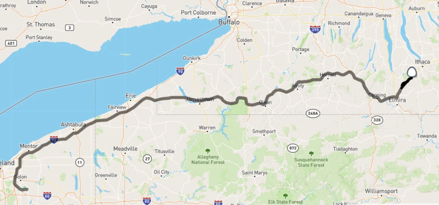
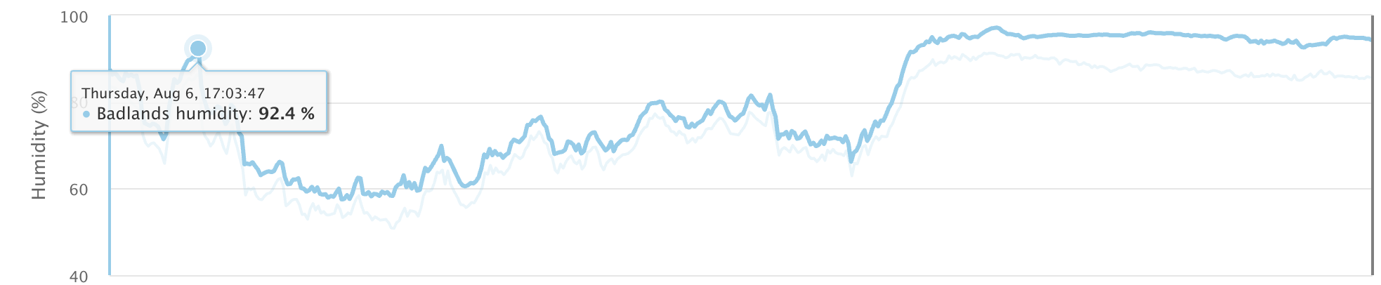
Figure A1: GPS coordinates (top) and humidity (bottom) from two sensors (called Badlands and Joshua Tree).
07 AUG (Fri)
Aurora, OH → St. Louis, MO. We practiced paper-map navigation with my aunt's Rand McNally atlas. Again, thunderstorms show up as sudden surges in humidity in the sensor data (Figure A2). A migraine became severe enough that I briefly considered abandoning the trip altogether; medication and a nap worked. Elsa joked that it was dysentery. We built the first improvised active wet bubbler and developed Smokey the Box, with passive wet and dry sampling. HRRR smoke forecasting using Python. Our soundtrack included lots of Hamilton and our discussions focused on US History. Evening Midwestern observations and smoke aloft; Gateway Arch at night.
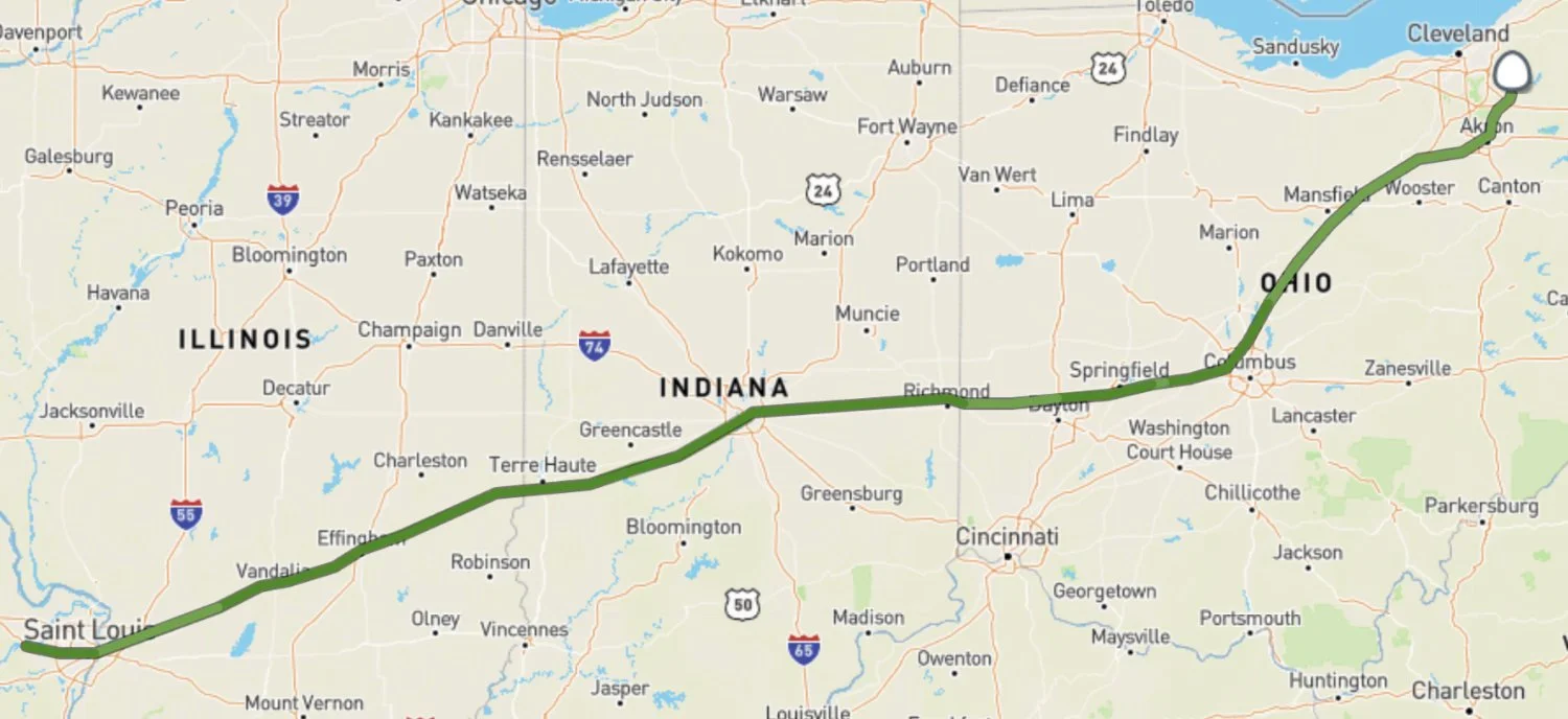
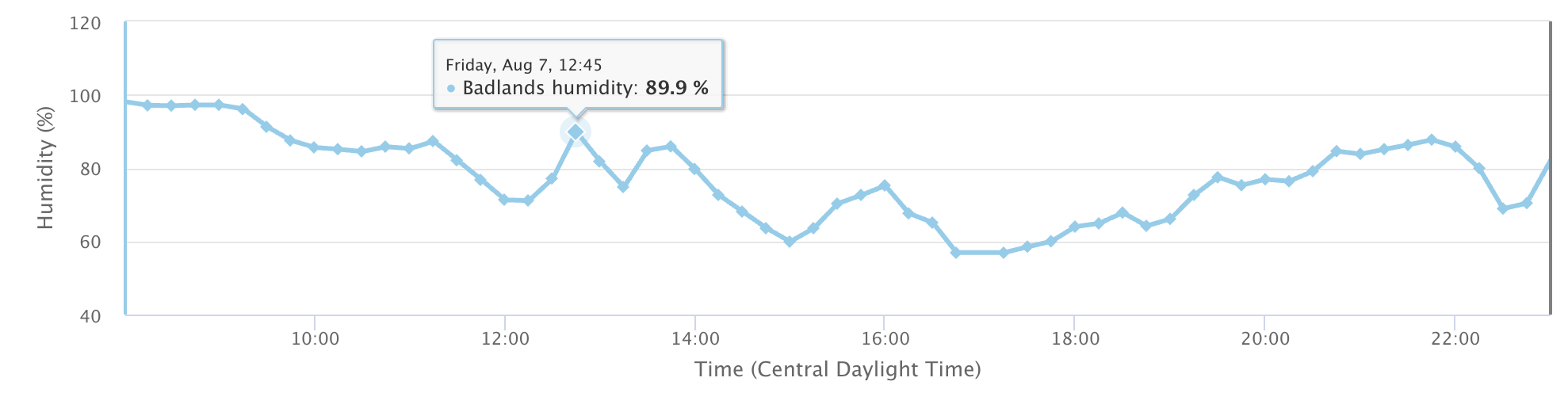
Figure A2. Same as Figure A1, but for August 7th.
No caption needed.
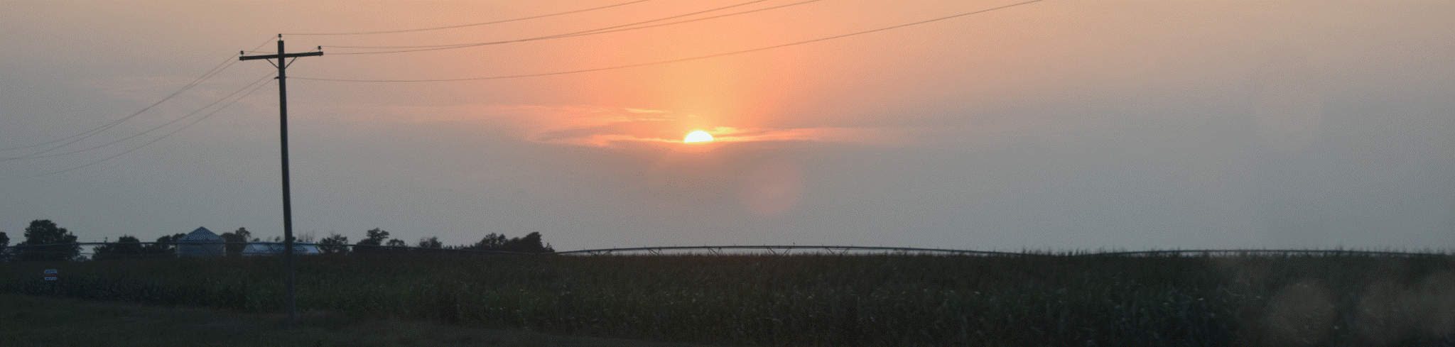
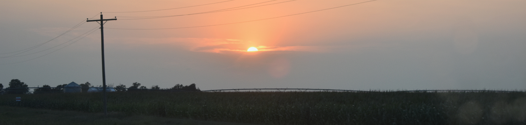
Sunset in Western Illinois.
Elsa's Notes: The midwest is very midwestern. Pretty sure we saw two time travelers hitchhiking near Indianapolis. (They had a broken down convertible 1960s-era Chevy and were dressed like characters from Grease).
08 AUG (Sat)
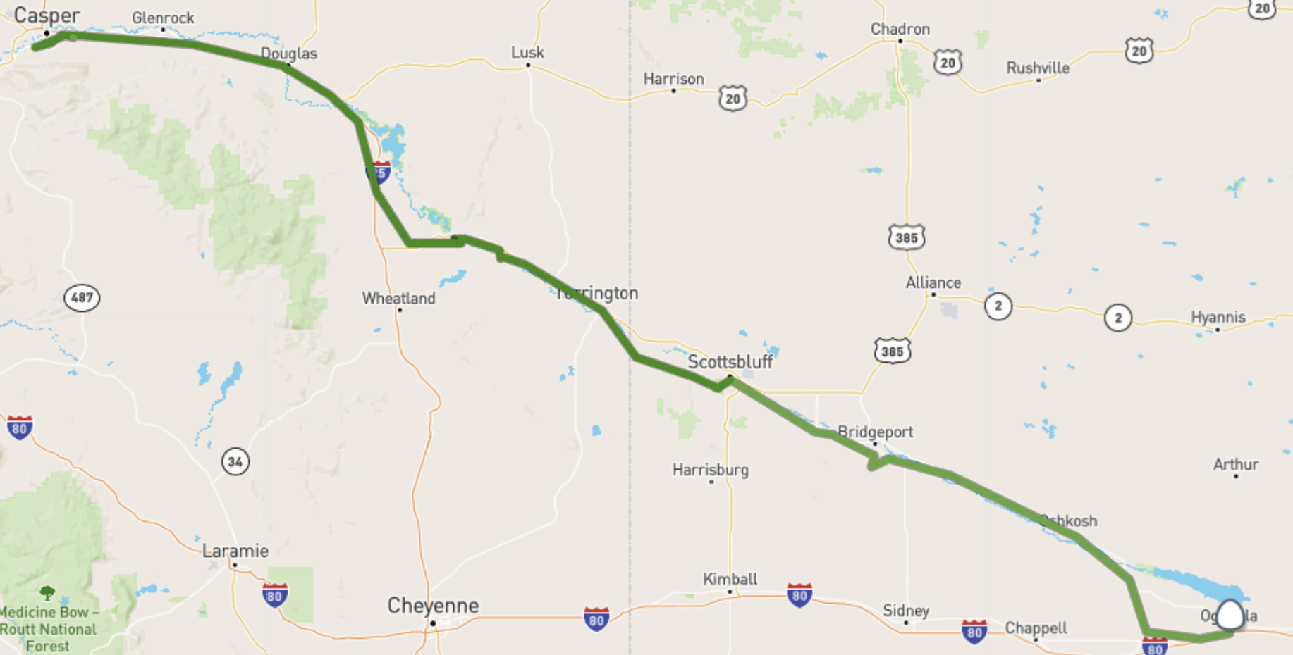
St. Louis → Ogallala, NE. Cicadas. Orange smoky sunrise; matcha and more forecast-code work. Independence and Oregon Trail museum; Kansas City; Little/Big Blue country; accidental industrial/grain-elevator stop; Alcove Springs; Marysville/Pony Express; Plains agriculture and dead-cottonwood observation. Increasing reflection on Oregon Trail suffering, Indigenous history, and deficiencies of older interpretation. Fort Kearny around dusk; long nighttime push to Ogallala. Gradual increase in elevation (Figure A3) Soundtrack included Bad Religion (Hills of Los Angeles), Smashing Pumpkins, Nirvana, more Hamilton, and the Grateful Dead.
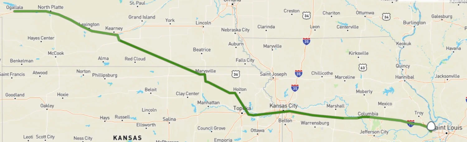
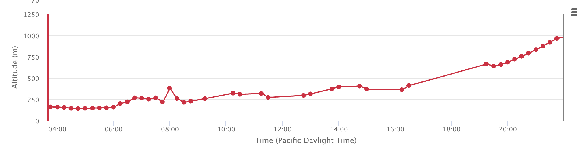
Figure A3. Elevation recorded from before dawn (near St. Louis) to our arrival in Ogallala Nebraska.
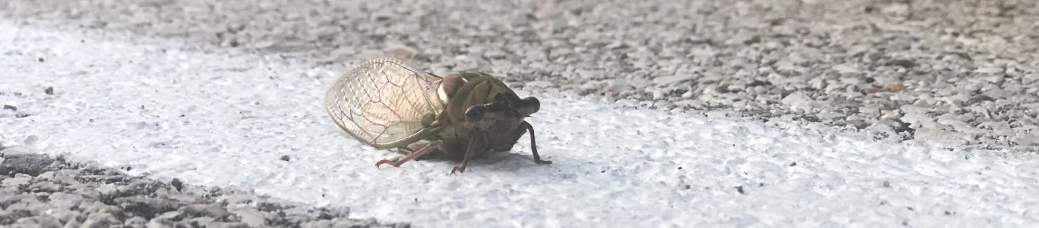
Insects found on car before dawn.
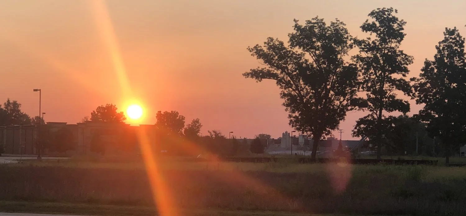
Sunrise colored by smoke.
09 AUG (Sun)
Ogallala → Casper. Early departure into dense fog/dew. North Platte; Courthouse/Jail Rocks; fog burned away to reveal substantial smoke. We questioned aerosol loading and fog formation. Safeway parking-lot construction of improved wet sampler using a turkey baster. Scotts Bluff; tape added as another dry sampler. Fort Laramie; enormous coal trains; Register Cliff and ~4-ft-deep wagon ruts; rattlesnake/whiskey story. Possibility of road dust contaminated passive samples. Wyoming energy infrastructure—coal, oil/gas, wind, solar—and violent winds/truck wash. Power-system trouble solved with a hotel cable in Casper.
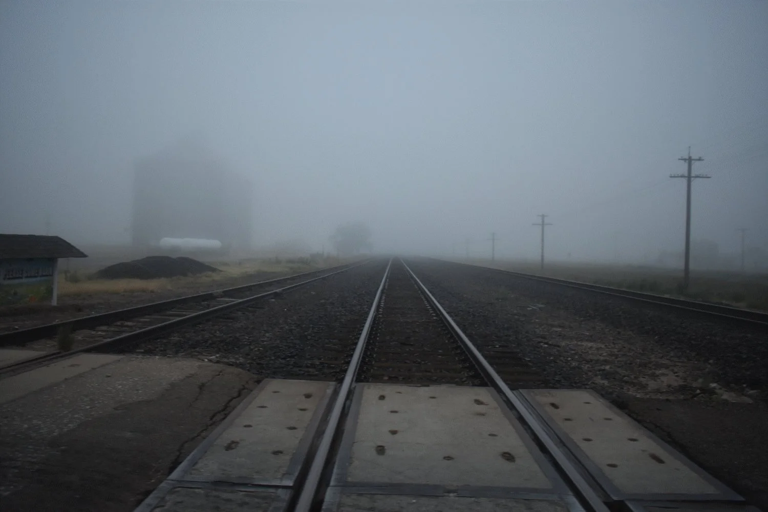
Train tracks near Ogallala, NE, running alongside the Platte River. The Oregon Trail followed the low elevation passes and waterways, and the railway lines often followed those same corridors.
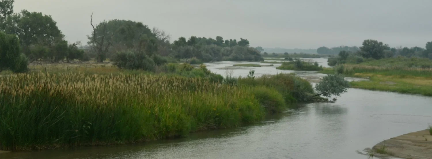
Platte River, Nebraska. “Platte” comes from the French word meaning, “flat,” like a plate.
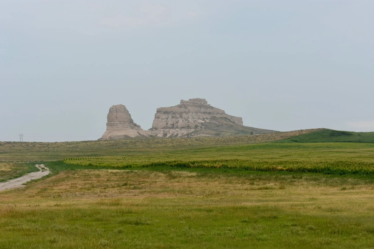
Courthouse and Jail Rocks, NE.
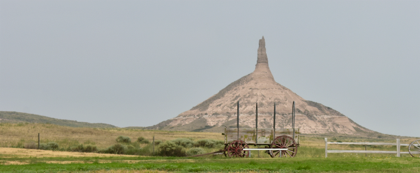
Chimney Rock, NE.
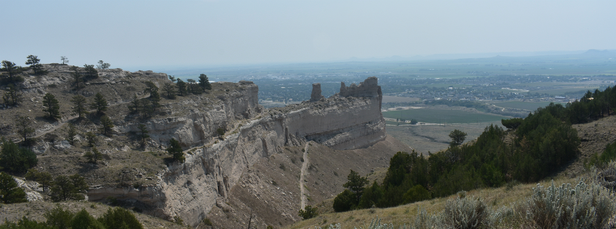
Scott’s Bluff, NE.
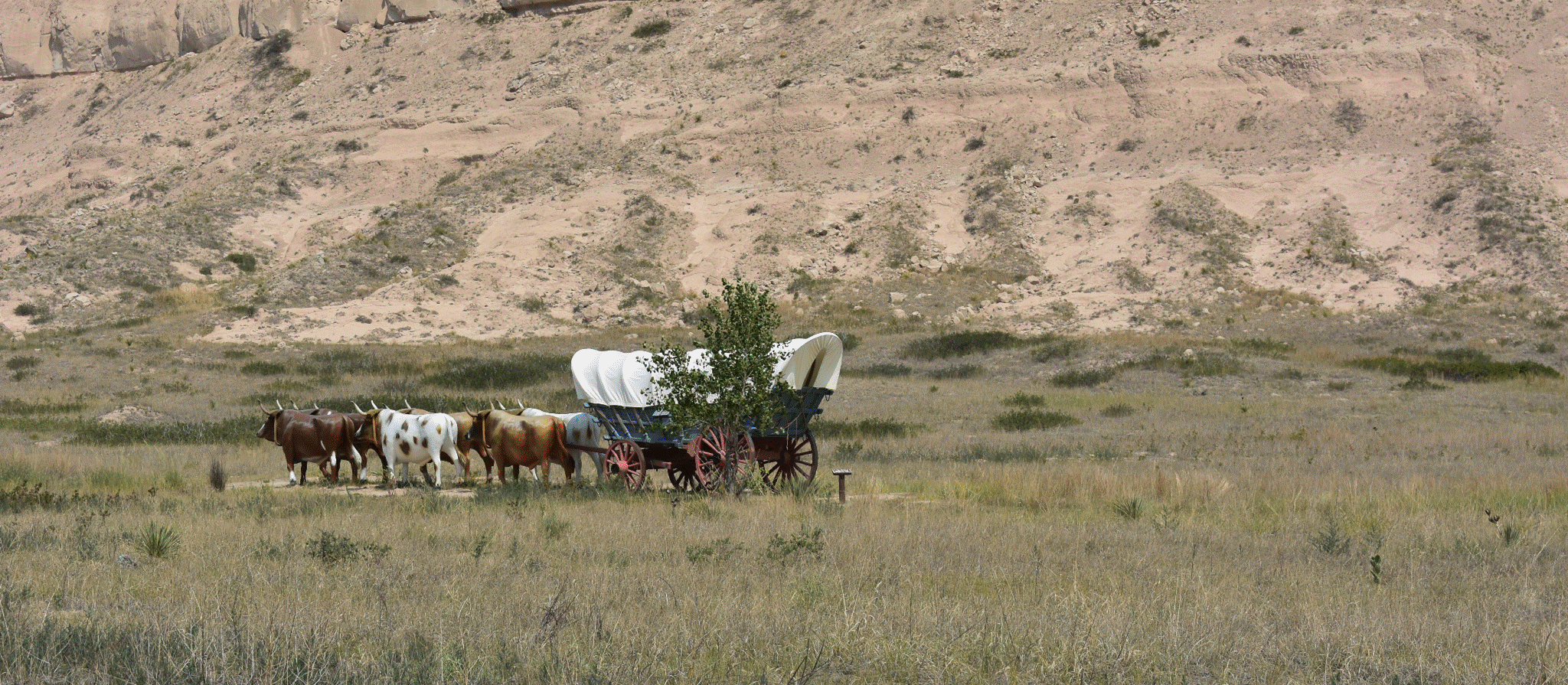
Scott’s Bluff, NE.
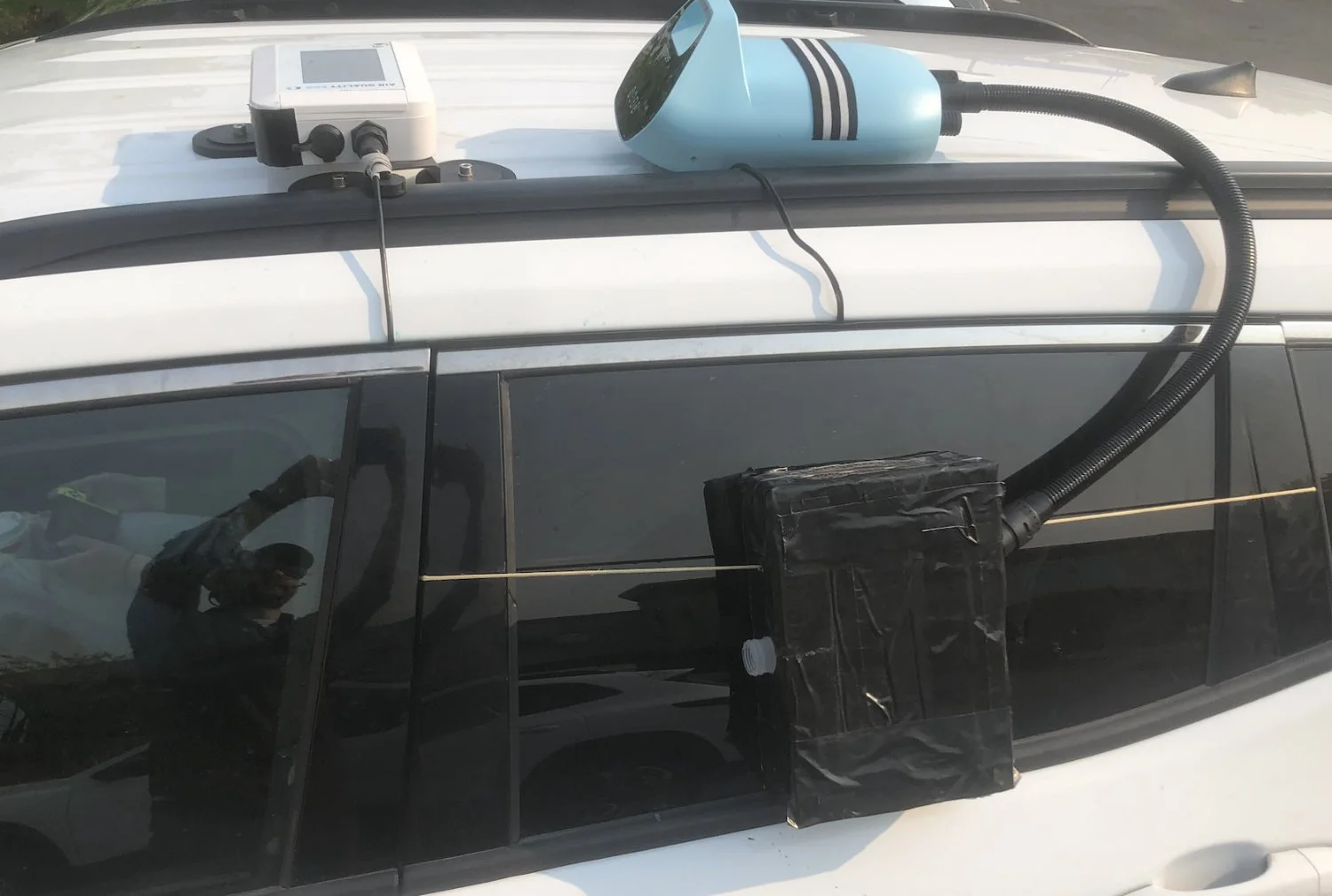
Active Sampler (powered by kayak pump)
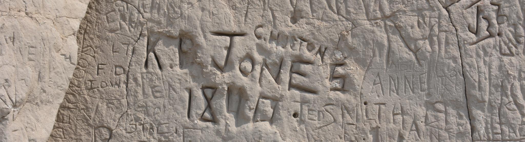
19th century vandalism of rocks along the Oregon Trail (Register Cliff, Guernsey, WY).
10 AUG (Mon)
Casper → Boise. Air initially much clearer at higher elevation. Independence Rock interrupted by an urgent wildfire evacuation alert. Paper map became essential because of poor service. Route toward Split Rock/South Pass intersected evacuation concerns. We adopted the practical rule that half a tank = empty. We encountered a small active smoke plume, then a substantially larger fire with visible flames, crews and aircraft near the highway. First serious discrete smoke samples, followed by water/tape change at a clean-air overlook. Continental Divide/South Pass, extreme isolation, construction, eventual relief at reaching the interstate. Increasing smoke through Idaho/Snake River country; extraordinary orange smoky sunset; Boise in very poor air.
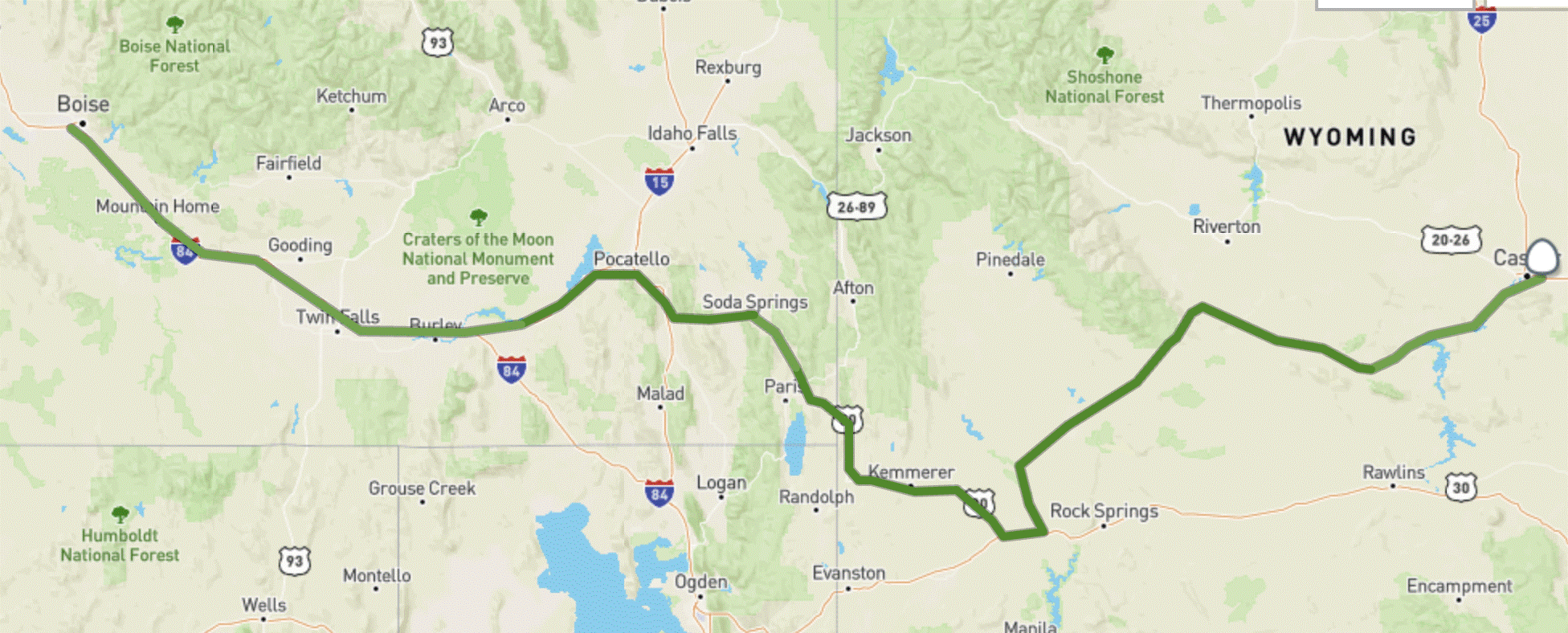
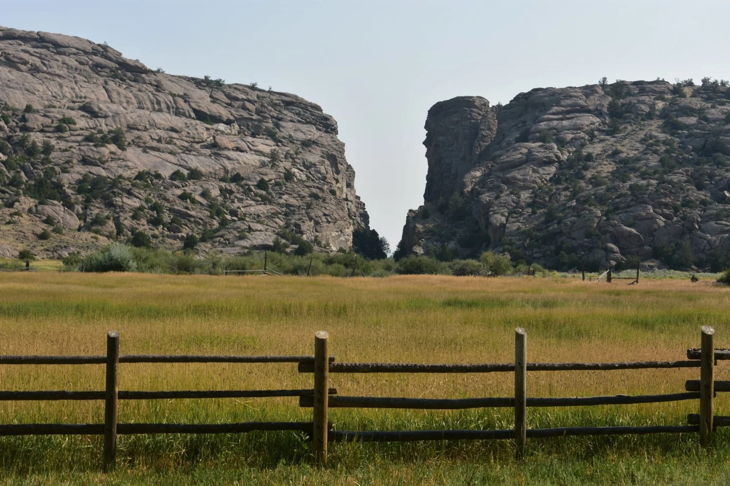
Split Rock, WY.
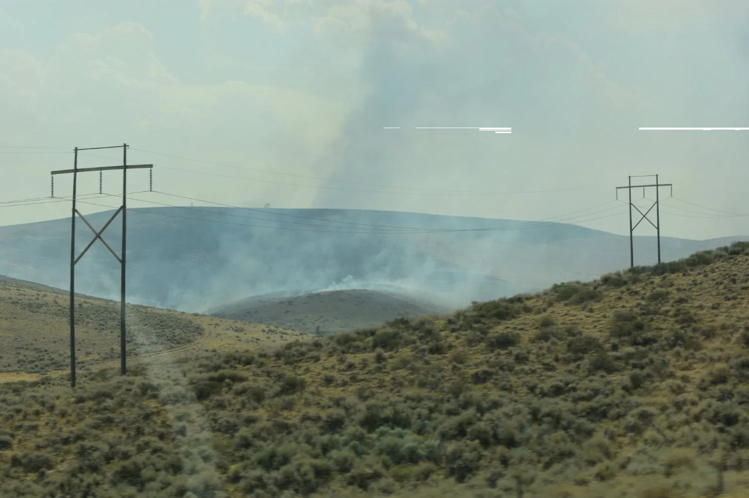
Active Wildfire near South Pass, WY.
Elsa's Notes: Things got very intense a couple of hours before this. We received “LEAVE NOW” alerts on our phones, lost cell phone reception, used a paper map, filled up on gas, and came within about 100 ft of an active fire. There were grass fires and forest fires that had started the night before and were not even remotely under control. Fire crews had not yet even arrived, or there were none available because they were fighting other blazes. I remember my dad’s aunt saying something like, “just remember in Wyoming that half is the new empty,” and I could see why.
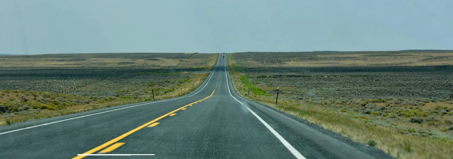
South Pass, WY.
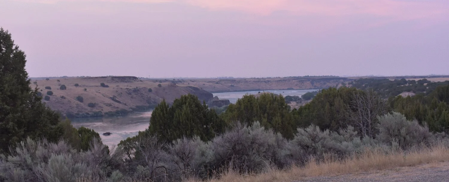
Upper Snake River, Idaho.
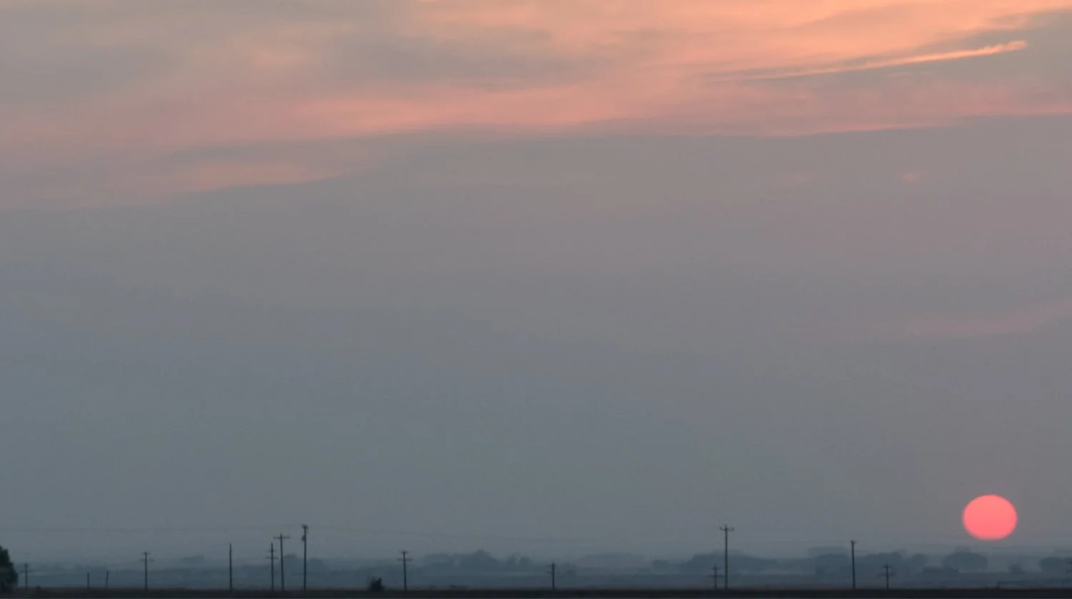
Smokey Sunset, Idaho.
Elsa's Notes: Soda Springs is a 0/2 (no soda and no springs). The man-made geyser, despite the smashing reviews on google, is incredibly boring.
11 AUG (Tue)
Boise → Lake Oswego. We became more disciplined about plume-by-plume sampling and changing water/tape. We tested a second bubbler design with narrower/deeper submerged intake—it failed, probably from excessive pressure resistance. Original Smokey continued working; roof tape visibly yellowed. We talked with former student Elena about aerosol science. Baker City Oregon Trail Interpretive Center; emotional response to the documentary and its treatment of emigrant and Indigenous history. Reflections on the trip together, American mythology, infrastructure, policy and the energy transition. Smoke finally cleared in the Columbia Gorge; PM around 1–2; sunset near where we were married; arrival at grandparents home.
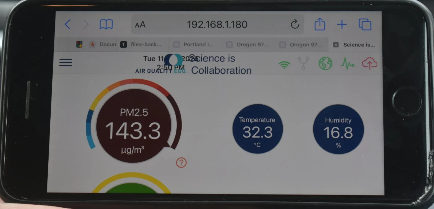
Outdoor Air Quality west of Boise, Idaho (data synced to iPhone).
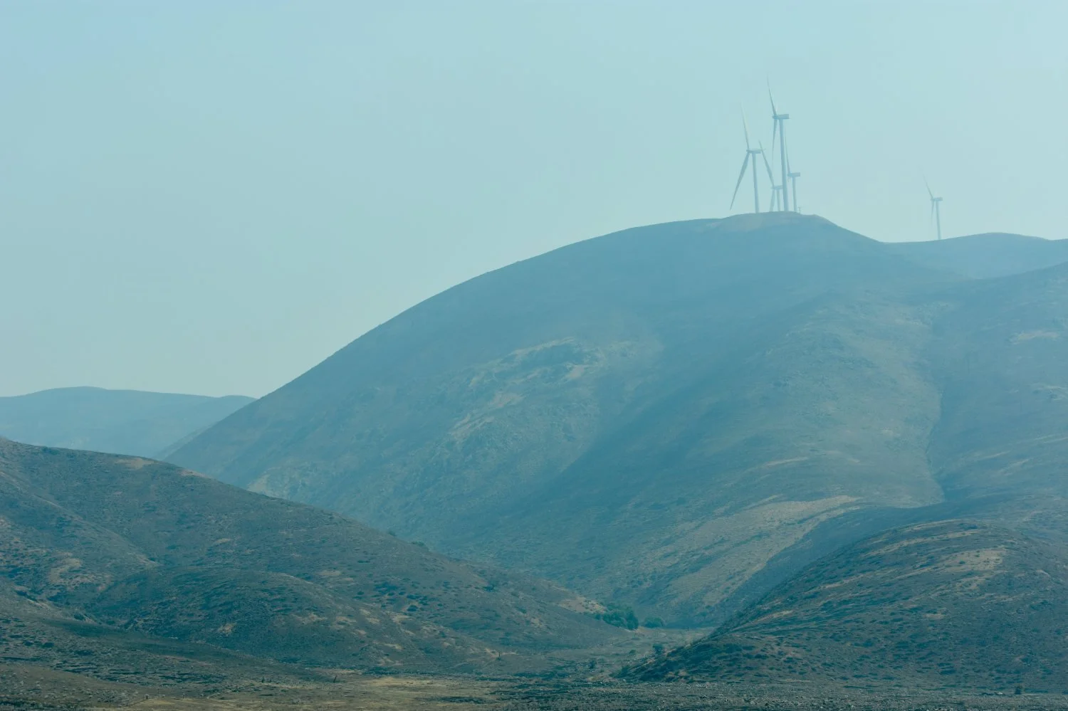
Windmills atop recently burned hillsides in Eastern Oregon.
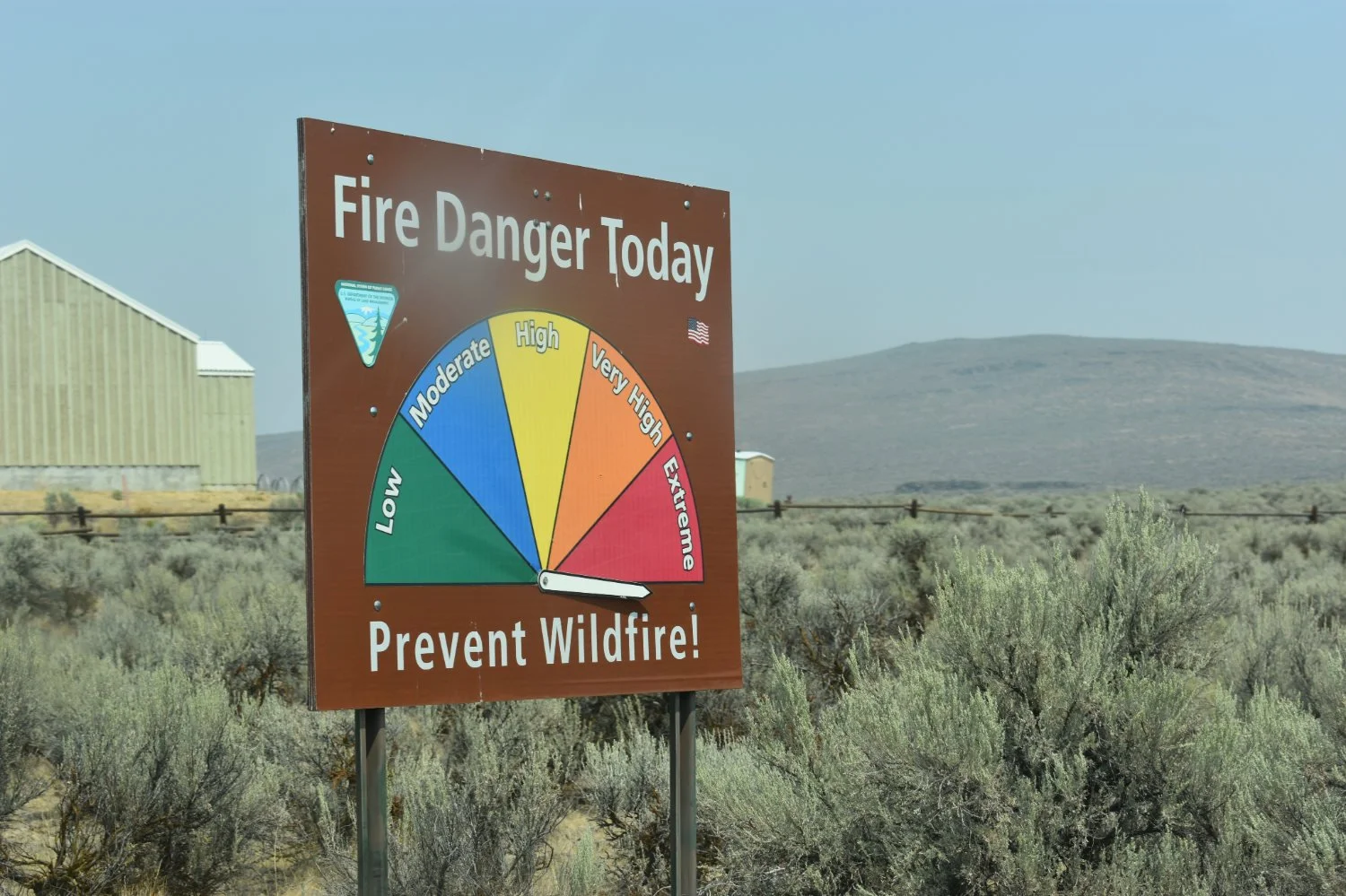
Entrance to Trails Museum, Bakersfield, Oregon.
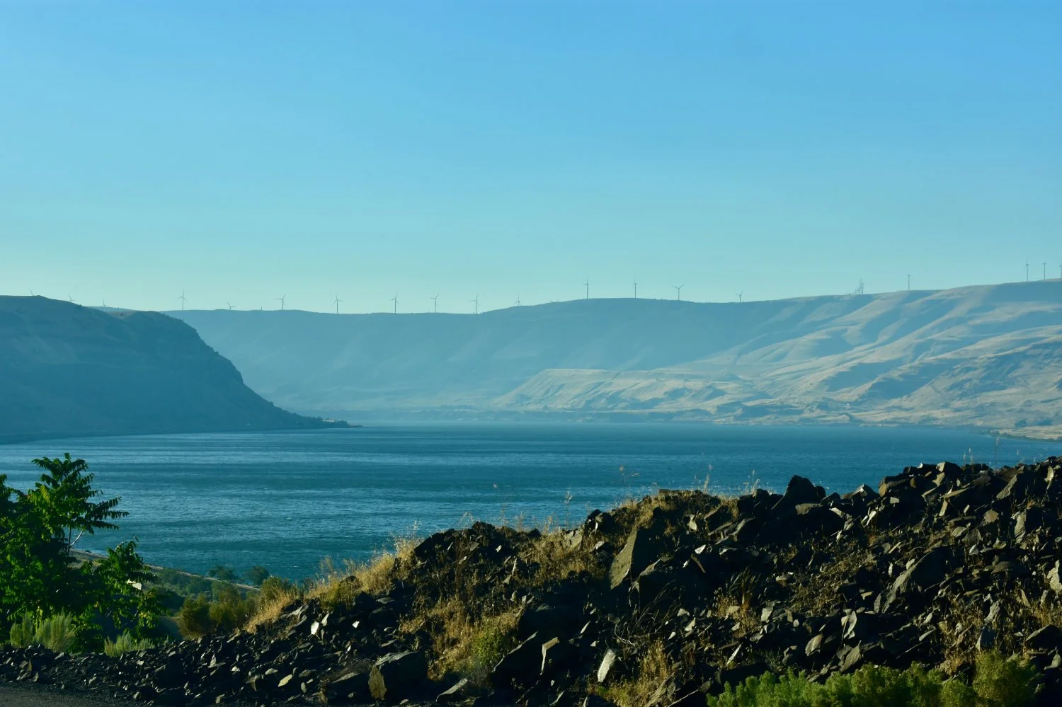
Columbia River (we decided not to forge).
Elsa's Notes: Museum workers were very apologetic because we couldn't see anything due to the smoke.. We kind of looked at one another like, “well, we actually came for the smoke, but this would be too bizzare to admit.” Actually, admitting to the museum staff that we’d just driven the Oregon Trail to collect smoke seemed impossible to explain to anyone, so we didn’t try. This museum seemed more accurate (at least the little documentary they played) to the real indigenous story of the trail but still kept out a lot of stuff.
APPENDIX III: Materials & Methods
Air Quality Eggs (Digital Sensors)
Details on the Air Quality Egg sensors can be found elsewhere. Briefly, each instrument makes high-temporal-resolution measurements of fine particulate matter (PM1, PM2.5, and PM10), along with CO2, water vapor, temperature, and pressure. A Raspberry Pi handles data collection, writes the measurements to an SD card, and manages connections to the cloud. A touchscreen interface allows us to monitor the instruments and check their status in the field.
We brought two wireless hotspots to provide redundant internet connections, along with two durable camping batteries, a solar panel, and an EcoFlow charging station (the goal being to maximize uptime, even at night when the car was off). The eggs do not include an internal power source (because it would interfere with temperature measurements), so they only work when they have power; one of the practical questions we wanted to answer was how reliably we could keep the entire system running during long days of driving and sampling.
We mounted two Air Quality Eggs on the exterior of the vehicle. One used a hook-based mounting system on the right passenger side window, while the other used neodymium magnets. The two exterior sensors gave us redundancy and also allowed us to compare measurements from slightly different positions in the airflow around the vehicle. We kept a third Egg inside the car to measure cabin air quality and provide an indoor comparison with the two exterior instruments.
We quickly learned that the orientation of the sensors mattered: at highway speeds, small differences in angle, intake obstructions, and airflow around the vehicle could produce differences between the sensors that largely disappeared when the car stopped. Those early discrepancies became part of the experiment itself and led us to make several adjustments to the mounting and intake configurations as the trip progressed.
Aerosol Collection
We tested three simple aerosol-collection approaches: an active wet sampler, a passive wet sampler, and a dry tape sampler. All three to be inexpensive, reproducible, and grounded in basic aerosol physics. Aerosol particles are more massive than the surrounding gas molecules, so when airflow changes direction, the particles carry more inertia than the gas. Accordingly, changes in direction of airflow and contact with water should increase the chance that particles leave the gas and enter the liquid, where we can later analyze them for contaminants.
Active wet sampler
The active sampler pulled air through a simple percolator using an inflatable kayak pump running in deflate mode. We used this system when the car was stopped and we wanted to collect the cleanest smoke sample we could from a particular location.
The pump drew ambient air through the sampler and forced it into contact with deionized water. We used the active sampler for targeted collection in especially smoky locations, including areas near active fires and firefighter encampments, where we wanted to minimize contamination from road dust and other material associated with driving.
Passive wet sampler
The passive sampler used the motion of the car itself to provide the airflow. We built the intake from a plastic funnel and a sawed-off turkey baster and positioned it so that air flowed into the sampler as the vehicle moved.
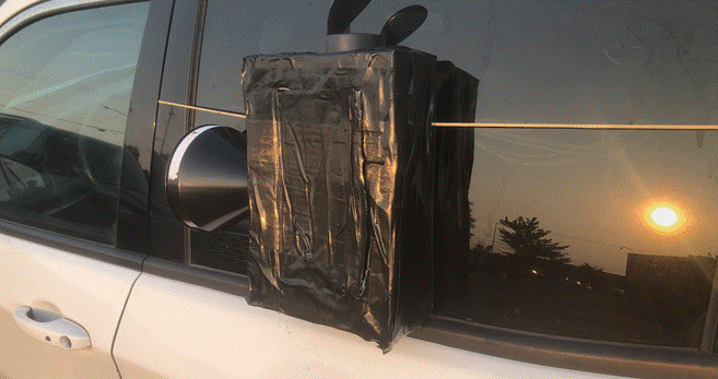
This design allowed us to collect wet aerosol samples while driving transects and therefore gave us much broader spatial coverage. It also carried a greater risk of collecting material unrelated to wildfire smoke, including road dust, agricultural dust, insects, vehicle emissions, and other particles encountered along the route.
The passive sampler therefore worked best for broad transects, while the active sampler allowed us to stop and collect more targeted smoke samples.
Dry aerosol sampling
We also collected dry aerosol samples using pieces of adhesive tape attached to the front of the exterior sensors with the sticky side facing outward.
The tape provided a simple way to collect particles directly from the airstream during travel. We could later examine those particles under a microscope or scanning electron microscope to look at their size, shape, and composition.